
Trace a Bloomington Street
A street directory search can establish who owns a parcel, who signed a recorded land document, and who appeared at an address in a dated directory. It cannot produce a full current household list. Begin with the McLean County Property Tax Inquiry, which accepts house-number ranges, street name, city, owner, parcel number, sales data, property class, and legal description. Treat the result as a tax lead. The Recorder confirms legal ownership.
- Enter the house number and street in the county tax portal. Save the parcel identification number, or PIN.
- Use the McGIS layer to view the parcel shape and nearby PINs. It does not expose an owner or street-address field.
- Check the correct election authority if voter confirmation is relevant and legally permitted.
- Search the Recorder by owner names, then read the deed image and legal description.
- Move backward through criss-cross directories, maps, permits, and newspapers for dated household evidence.
Bloomington Street Search Fields
The county portal allows a block search without an owner's name. House Number Low and High can define a range, while Street Name and City narrow it. None of the inspected fields was visibly required. Use fewer fields first because abbreviations, directional letters, and old spellings can hide a match.
| Field | Form | Street use |
|---|---|---|
| House Number Low/High | Number | Scan a block range |
| Street Name | Text | Find matching parcels |
| City | Text | Limit place name |
| Owner Name | Text | Confirm a known owner |
| Parcel Number | Text | Return to one parcel |
| Legal Description | Text | Bridge a deed or plat |
Mobile homes use a separate tab with mobile-home number, owner, house number, street, and city. The system warns that its data is informational and not proof of title.
Bloomington Street Direction Rules
Bloomington's address-numbering code uses Main Street as the east-west dividing line and Front Street as the north-south dividing line. Addresses west of Main use “W,” east use “E,” north of Front use “N,” and south use “S.” The code generally assigns 100 numbers per block. Those letters are evidence, not decoration. Dropping one can move a search to a different side of the grid.
Old records may use a prior street name or number. The Museum older-house guide recommends tracing name and number changes through directories, maps, plats, deeds, and abstracts. Search both the old and current form, with and without a directional prefix.
Read Bloomington's address-numbering code.
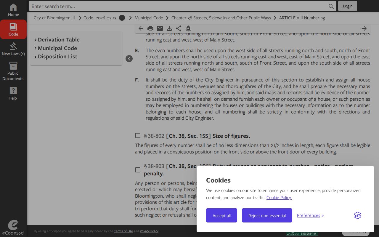
The code capture explains why a directional letter must stay attached to a Bloomington address.
Bloomington Streets in McGIS
The McGIS parcel layer supplies parcel geometry, PIN, deed acreage, computed acreage, status, source, and change metadata. It does not publish owner name or street address in the inspected layer schema. Use it to see shapes and adjoining parcels, then carry each PIN back to the property portal.
This distinction prevents a common error. A polygon tells where a parcel sits, not who occupies it. The city Maps and GIS page also links street, ward, zoning, infrastructure, crime, and downtown maps. These layers can explain civic geography, but none is a resident roll.
Bloomington Deeds Along a Street
A modern address may not appear in an older deed. Land instruments often rely on a legal description, which identifies land by lot, block, subdivision, metes and bounds, or another recorded form. Start with a PIN and current owner from the tax search. Then use the McLean Recorder portal to find grantors and grantees and inspect document images.
The Recorder's in-person name index is reported back to 1837. Online access was changing from eSearch to RECORDhub after August 2026's last weekend. Older data may have spelling and PIN gaps, and recovered entries tagged RDX may be less complete. Counter help, phone support at 309-888-5170, and the paper index remain part of the access chain.
Bloomington Address Permit Trail
Building Safety publishes recent plan-review and permit-issued listings. Visible fields can include location, work description, review status, property owner, contractor, valuation, and project details. The windows are short: plan reviews cover the prior 60 days and issued permits the prior 30 days. These are dated project records, not proof of who lives there.
For older files, submit a focused request through Bloomington FOIA. Give the address, date range, department, and permit or case number if known. Requests can go through JustFOIA, email, fax, mail, or in person. Asking for an existing permit file is far stronger than asking the city to create a list of residents.
Bloomington Records Searchable by Street
Each address-keyed source has a different keeper and time span. Combining them creates a Bloomington street directory trail, but each row must retain its own meaning. The tax roll points to a billed owner. GIS maps land. Deeds document land interests. Permit reports date work. Historical directories name listed householders at publication time.
| Record Set | Keeper | What It Shows | Access |
|---|---|---|---|
| Property tax inquiry | McLean County | Billed owner, parcel criteria, sales | Free web search and office |
| GIS parcel layer | McGIS | PIN, shape, acreage, source data | Free map and REST service |
| Deeds and liens | County Recorder | Parties, document, legal description | Portal, counter, phone |
| Voter confirmation | City commission or county | Registration under legal limits | State lookup and local office |
| Building permits | Bloomington Building Safety | Dated work and project parties | Recent list; older by FOIA |
| City directories | Library and Museum | Dated householder listing | Stacks and digital volumes |
The PIN is the best bridge from a mapped parcel to tax and deed research. The street form links permits and dated directories. When records conflict, prefer the original document and its date over a later index entry.
Bloomington Street Maps by Era
Sanborn fire-insurance maps add the building footprint to the street record. The Library of Congress catalog includes Bloomington sheets, while the Bloomington Public Library holdings guide lists maps, plats, atlases, and local-history tools. A Sanborn sheet can show the shape and use of a structure in one survey year. It does not name every person inside.
Browse the Library of Congress Bloomington Sanborn results.
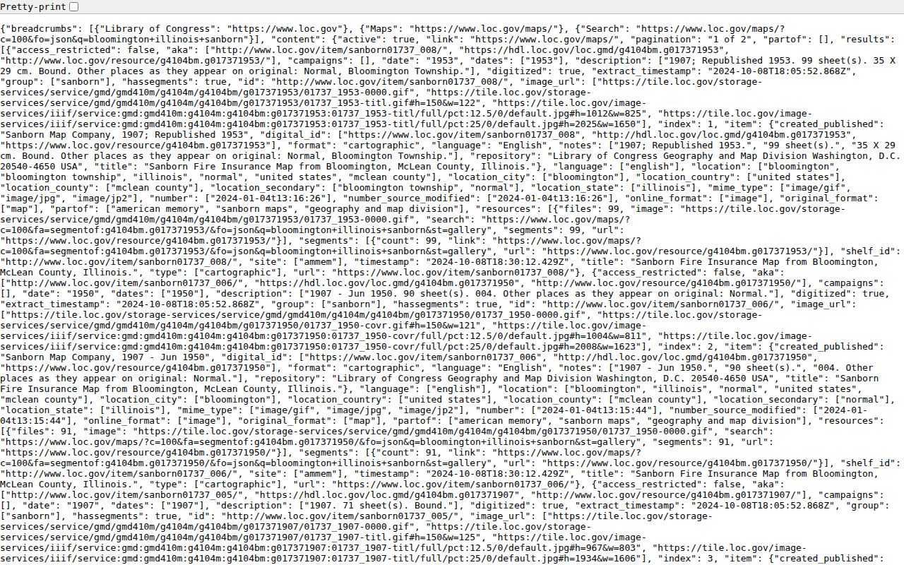
The catalog capture provides a dated map route that can be paired with a directory listing and deed chain.
Bloomington Directory Street Index
The digitized 1893 Bloomington directory includes resident, classified, business, and street-number sections. A street-number section works like an early reverse directory: search the street, inspect nearby numbers, then compare the named line with the alphabetical resident entry. One line may combine a resident, spouse or widow note, occupation, business role, and house number.
Machine-read OCR is quick but prone to errors from old type and damaged scans. Search the plain text with spelling variants, then open the page image. A dated directory is a historical snapshot. The Bloomington city directory covers the full collection; this street directory uses it only to place names along an address line.
Inspect the 1893 Bloomington directory scan.
The scan is the evidence to cite after an OCR result identifies a likely page.
Bloomington Street Record Terms
Address research moves between tax, map, deed, and directory language. These terms keep the record trail clear.
- Parcel
- A mapped unit of land, commonly tracked by a PIN.
- Situs address
- The physical location of property, which may differ from the tax mailing address.
- Plat
- A recorded map of lots, blocks, streets, or subdivisions.
- Criss-cross directory
- A directory arranged by street address or phone number.
- Legal description
- The land wording used in a deed, which may omit the current house number.
Write down both the displayed value and source date. That small habit makes later conflicts much easier to resolve.
Bloomington Streets Cross Boundaries
A street can cross a ward, neighborhood, ZIP, township, or even the city limit. Those labels serve different purposes. Bloomington's current ward system has nine wards. Maps approved in July 2022 took effect May 1, 2023. The city's Neighborhood Identity Research mapped 34 neighborhoods and districts from surveys and association material, but it warns that drawn lines may not match how residents understand their community.
Keep the address as the street directory key. Use the ward address lookup for the current ward and the city neighborhood source only for the label it documents. GAP, Dimmitt's Grove, West Bloomington, Franklin Square, and other names arise from different planning or history sources. None replaces a parcel boundary or deed.
ZIP adds another trap. USPS delivery geography and Census ZCTAs do not equal Bloomington city limits. Record the mailing ZIP, jurisdiction, ward, and neighborhood separately when the distinction matters.
Bloomington Street Record Gaps
A failed search is a research note, not a final answer. The Illinois State Archives documents a June 19, 1900 county fire that caused record loss or damage. Older Recorder data can also contain misspellings, missing documents, and PIN issues. Online access may be thinner than the courthouse index, library shelf, or archive catalog.
If a street result disappears between eras, try alternate spellings and directional forms. Check a city directory, newspaper, church register, cemetery source, plat, and Sanborn map. IRAD at Illinois State University holds McLean local-government series with dates that vary by record type. The Museum's finding aids describe hundreds of family, organization, cemetery, and railroad collections.
Label the outcome with care: “no online match found on the search date” is accurate. “No record exists” usually is not.
Limits of Bloomington Street Records
No Bloomington street directory source supplies a complete current household. A property card names an owner or taxpayer, not each occupant. The public McGIS layer maps parcel geometry but exposes no owner or street-address field. Voter data has statutory limits, and Address Confidentiality Program participants receive protections. Vehicle address data is restricted by federal and state law. Utility customer records were not found as an open resident list.
Neighborhood, ward, ZIP, and mailing-city labels also describe different boundaries. Bloomington has nine wards, and city research mapped 34 neighborhood or district areas while warning that the lines may not match how people identify their community. Keep the exact street address and source date at the center of the search.
Lawful use. Bloomington address records are for lawful personal, historical, property, or civic research. Never use them to stalk, threaten, intimidate, harass, or harm a person.