
Bloomington Neighbors by Record
Official Bloomington block research begins with geography. McGIS outlines parcels and supplies parcel identification numbers, while the county tax portal can search address and ownership leads. Recorder instruments confirm recorded interests. City planning pages supply neighborhood or ward context, and dated directories reconstruct an older block. These sources describe parcels, filings, and listings, not a complete roll of nearby households.
| Source | What It Shows About a Block | Access |
|---|---|---|
| McGIS parcel layer | Parcel polygons, PIN, acreage, source, and change data | Free map and REST query; no owner/address field |
| McLean Property Tax Inquiry | Address, owner, sale, class, and legal-description leads | Open search; not proof of title or occupancy |
| Recorder index | Grantor, grantee, and recorded land instruments | Online portal and counter; historical gaps |
| City neighborhood research | Mapped district and planning context | Official page; no complete resident roster |
| Criss-cross directories | Dated households arranged by address | Bloomington Public Library, in person |
An owner can live elsewhere, and an occupant may own nothing recorded at the address. A permit can name a project owner or contractor without naming residents. Treat each record as one narrow fact.
Bloomington Parcel Shapes First
The McGIS parcel service supplies the cleanest starting geometry. Its fields include PIN, computed acreage, source, change date, and map shape. Owner name and situs address are absent. That limit is useful: a polygon shows the parcel beside another parcel, not who lives there.
The public parcel service makes the block layout visible.
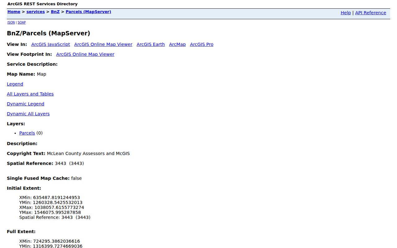
Save each PIN and source date. Parcel boundaries can change, and a tax record or deed must supply the next fact.
Check Bloomington Neighbor Parcels
The McLean County Property Records gateway links tax, assessor, township, and GIS tools. The tax inquiry accepts a parcel number, owner, house-number range, street, city, sale range, tax code, district, class, and legal description. It can turn nearby PINs into ownership leads, but its disclaimer says tax data is not proof of legal ownership.
The official gateway shows the available county routes.
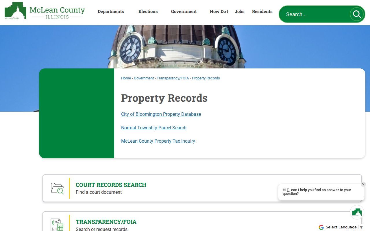
Confirm a claimed owner through the Recorder's deed index. Do not turn a mailing address into an occupancy claim.
Bloomington Neighborhood Names
Bloomington's official Neighborhood Identity Research reports 34 mapped neighborhoods or districts based on historic surveys and homeowners' associations. It also warns that boundaries may not match how residents interact. GAP, meaning Gridley, Allin, Prickett, is named as an area with mapping activity. Dimmitt's Grove and West Bloomington have planning context, while Franklin Square, East Grove Street, Whites Place, Davis-Jefferson, and Stevensonville appear in city or Museum sources.
No complete official association contact list or resident roster was located. The labels are still valuable when tied to their source. A planning area can point toward meetings, plans, preservation files, or local history, but it is not a legal parcel line and cannot identify every Bloomington neighbor.
| Community source | Public block value | Directory status |
|---|---|---|
| Neighborhood Identity Research | 34 mapped areas and boundary caution | No full association roster located |
| GAP | Named Gridley, Allin, Prickett mapping area | No member list located |
| Dimmitt's Grove | Plan and association context | No resident roll located |
| West Bloomington | Revitalization-plan geography | Plan, not household directory |
| Library and Museum | Dated club, church, school, and rail collections | Finding aids; access varies |
Bloomington Neighbors and Voter Data
The Illinois voter lookup is person-specific. It requires first name, last name, birth date, ZIP, street number, and street name. It has no browse-by-block mode. Bloomington also has its own Election Commission inside city limits, while McLean County Elections handles voters outside that authority. A postal city name does not settle which office applies.
Public election files follow 10 ILCS 5/1A-16. Full birth dates, Social Security numbers, phone numbers, home street numbers, and identifiable email portions are redacted, and use is limited. Address Confidentiality Program voters are withheld from public lists. A missing entry can be protected or reflect input and jurisdiction issues.
Note: Never use election data to compile, pressure, or intimidate a Bloomington block; ask the correct election authority about lawful access.
Official Bloomington Neighbor Sources
Official rolls answer narrow questions and identify their keeper. Commercial neighbor tools compile many sources, but freshness, correction rules, and identity matching vary. A polished result can still join the wrong person to a parcel. Return to the county, city, library, or Museum source before repeating a claim.
| Source type | Strength | Limit |
|---|---|---|
| GIS and tax records | Dated parcel and assessment leads | Not a household roster or title proof |
| Recorder instruments | Recorded interest and legal description | Ownership is not occupancy |
| City plans and maps | Ward, street, and community context | Planning labels are not resident lists |
| Commercial compilation | May gather many public snippets | Source date, match, and correction may be unclear |
For personal neighborhood curiosity, keep a source ledger with the date and fact type. Avoid publishing names when parcel geography or a community plan answers the question.
Map a Bloomington Neighbors Block
McGIS advertises Identify, Query, and Find operations. It can display the polygons around one PIN, but no exact radius or buffer control was confirmed. Work visually around the block and carry each parcel key into the next official system.
- Locate the street in the McLean County GIS hub and identify the target polygon.
- Save its PIN, then inspect polygons that touch or face it on the visible block.
- Search each PIN or address in the McLean Property Tax Inquiry.
- Use the Recorder index to confirm a deed or other recorded interest.
- Label the result as parcel or owner information, never as a full household.
This stays close to one address. Use the Bloomington street directory when research needs the full named street.
Past Bloomington Neighbors by Address
Historical city directories and criss-cross volumes can show a dated block in ways modern parcel tools cannot. Bloomington Public Library holds city directories from 1855 forward, almost complete, plus Cole address-oriented volumes from 1982 through 1996/97 and telephone books that are nearly continuous from 1965. The 1893 directory includes a street-number section as well as resident and business lists. Search the street, inspect the scan, and retain the year and page.
Old addresses need care. Front Street is Bloomington's north-south numbering base, Main Street is the east-west base, and directional prefixes matter. Yet the Museum warns that names and numbers can change, houses can move, and directories can contain errors. A person printed at an old address should never be presented as a current neighbor.
Library newspapers, cemetery volumes, yearbooks, and Museum finding aids can add dated community links. The Chicago and Alton collections are especially relevant to blocks shaped by rail and community organizations after the railroad arrived in 1853. These historical sources can explain a block's past without exposing a present private household.
Bloomington Block Records by Request
Recent building permits and plan-review lists are address-centered. Visible fields can include location, work description, status, owner, contractor, and valuation. Code compliance also accepts address-based reports, but its public page is a reporting route, not a person search. Older city material should be requested as a specific existing record.
The Bloomington City Clerk accepts requests through JustFOIA, email, fax, mail, or in person. A useful block request identifies a narrow address range, department, record type, and date span. Illinois FOIA asks the city to produce existing records, not create a custom answer about who lives nearby. The city lists a five-business-day response target with a possible statutory extension.
Permit and code records describe a project or government action. They cannot prove every occupant, and a contractor's appearance does not make that person a neighbor. Keep the record type in the citation.
Privacy for Bloomington Neighbors
Nearby parcel records do not disclose renters, children, household members, utility customers, delivery records, or all occupants. Illinois voter data redacts sensitive fields, and the public lookup requires one person's name, birth date, ZIP, street number, and street. It cannot enumerate a block. The Address Confidentiality Program can substitute an address for eligible survivors and keeps protected voters from public lists.
Lawful use. Looking up Bloomington neighbors is for lawful personal research. Never stalk, harass, threaten, target, or expose anyone on the block.
Label Bloomington Neighbor Findings
A short confidence label keeps a block search honest. Use “parcel geometry only” for a McGIS polygon, “tax search lead” for an assessment result, “recorded-interest lead” for an index hit, and “historical directory listing” for a dated printed entry. Reserve “certified record” for a copy issued and certified by the custodian. These labels prevent a narrow record from becoming a broad claim about Bloomington neighbors.
Record the date beside every label. USPS delivery names, ward boundaries, voter status, assessment details, and Recorder portals can change. The August 2026 transition from Recorder eSearch to RECORDhub shows why the interface and retrieval date belong in the notes. Older indexes also have gaps, so an absent deed hit is a reason to ask the counter, not proof that no instrument exists.
Common same-name errors can be reduced without exposing private facts. Compare the PIN and legal description for land records, the exact year and page for a directory, or the case number and lawful date clues for a court item. Stop when the evidence cannot distinguish two people. A useful block record is precise about uncertainty and sends the reader back to the named custodian.